
 0
0
 0
0
Consumer electronics reviews are almost always conducted under controlled conditions. The reviewer tests the GPS accuracy in a city park. The action camera gets dunked in a swimming pool. The smartwatch biometric sensors are evaluated on a treadmill. These tests are useful for comparing products against each other but they tell you very little about how the hardware performs when the environment stops cooperating, when the temperature drops 20 degrees in an hour, when the dust clogs every port, when the altitude is high enough to affect battery chemistry, and when getting the reading wrong has consequences beyond a skewed workout summary.
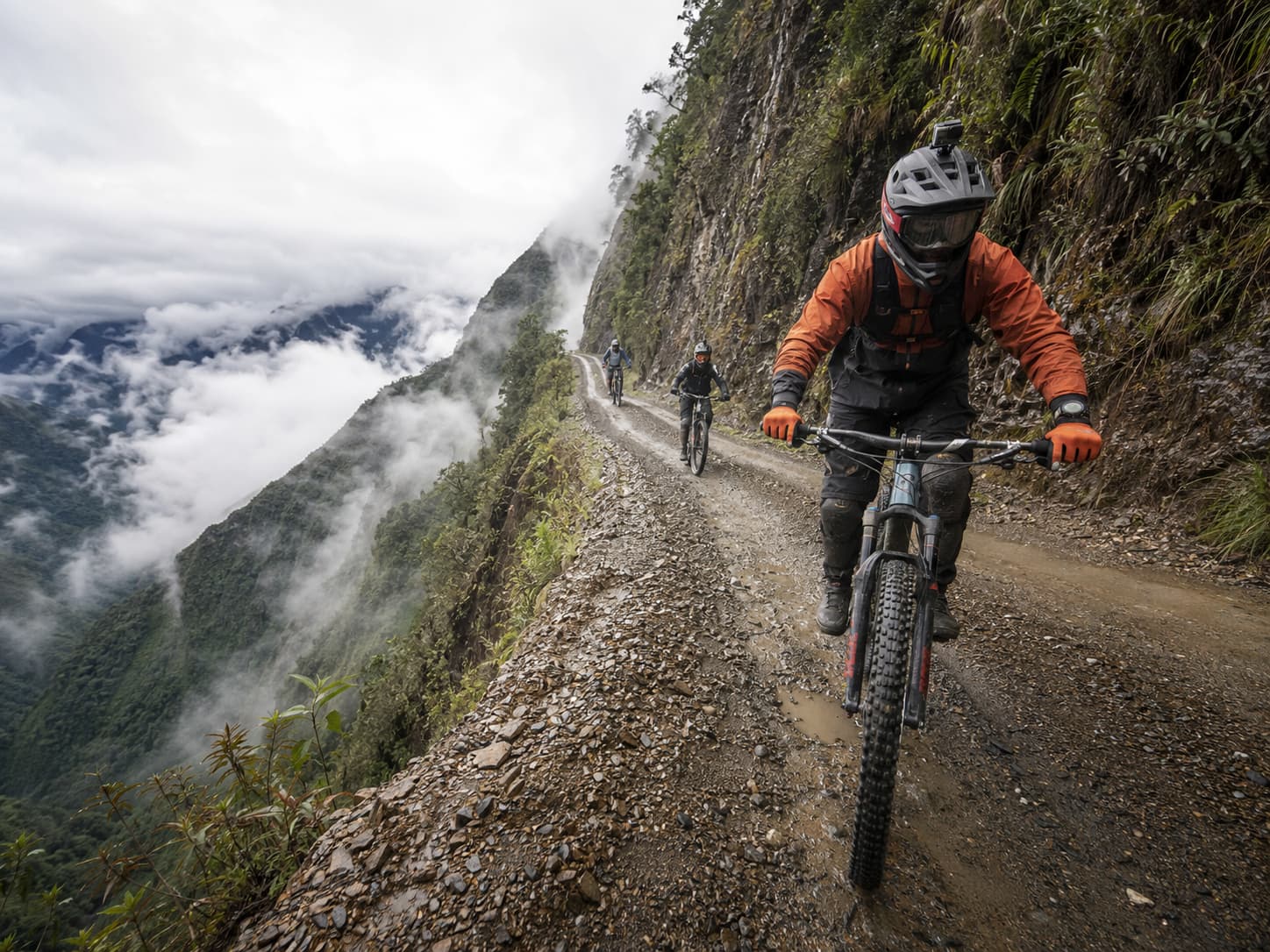
Bolivia’s Yungas Road, known globally as the Death Road, is a 64-kilometre mountain track that descends from La Paz at 4,650 metres above sea level to Coroico at around 1,200 metres, dropping through altitude zones that move from Andean altiplano through cloud forest to subtropical jungle in a single afternoon. For mountain bikers who ride it as a tour, it is one of the most extreme consumer experiences available on earth. For anyone who thinks about how technology performs in genuine edge cases, it is an extraordinary data point.
Here are eight reasons it belongs on the tech enthusiast’s travel list.
1. The Altitude Profile Breaks Consumer GPS in Ways That Controlled Tests Miss
The descent begins at La Cumbre pass at approximately 4,650 metres, one of the highest points on any mountain bike tour route in the world. At this altitude, the reduced atmospheric pressure affects GPS signal processing in ways that vary significantly between chipset generations and antenna designs. Consumer GPS devices that perform well at sea level or moderate elevation frequently show increased positional drift, slower cold-start lock times, and reduced altitude accuracy at this elevation, where the reduced air density changes the signal propagation environment.
The 3,500-metre descent over 64 kilometres also produces a continuous altitude measurement challenge: the barometric altimeters in consumer smartwatches and GPS units need to reconcile barometric pressure change with GPS altitude correction in real time across a descent profile that moves faster than most calibration algorithms expect. Devices that handle this smoothly demonstrate a level of sensor fusion that is worth noting. Devices that produce altitude graphs that look like someone sat on the sensor are equally informative.
2. The Dust and Moisture Conditions Are an IP Rating Reality Check
The Death Road descends through at least three distinct moisture environments in a single run. The upper section above the cloud line is cold, dry, and dusty in dry season, with fine silica-rich road dust that infiltrates every unsealed opening in a device casing. The cloud zone in the middle section is persistently wet, with low-lying cloud producing the kind of fine, all-surrounding moisture that is harder on sealing than direct rain because it approaches from every direction simultaneously. The lower section is subtropical, humid, and warm, with heavier rainfall possible even in dry season.
A device rated IP67 is tested in static immersion to one metre for thirty minutes. It is not tested in fine dust for two hours followed by cloud moisture followed by sub-tropical humidity while being subjected to the vibration of mountain bike riding on a rough gravel track. Real-world IP performance on the Death Road tells you more about a device’s actual environmental sealing than any laboratory rating does, which is why action camera and smartwatch manufacturers that run gear testing programs in extreme environments treat routes like this as more valuable than swimming pool tests.
3. Action Camera Performance in Dust and Vibration Determines What You Actually Capture
The Death Road is one of the most filmed adventure experiences in the world, and the contrast between what GoPro-mounted footage looks like from a smoothly descending rider versus a rider who is fighting the bike through a rough section demonstrates something useful about optical image stabilisation performance under real mechanical load. The vibration profile of a mountain bike on an unpaved track at speed produces frequencies that challenge OIS systems differently from the walking gait or running gait that most action camera stabilisation is optimised for.
Lens contamination from road dust is the other factor that controlled tests don’t address. Fine dust accumulating on a lens surface over a two-hour descent produces a gradual softening of the image that appears in the footage as what looks like a colour grade decision but is actually just a dirty lens. Cameras with effective lens covers that can be operated with gloves, or with self-cleaning lens surfaces, demonstrate a practical advantage on routes like this that no studio test reveals. The camera hardware decisions that determine low-light performance, sensor size, and lens quality all play out differently when the constraint is not a dark restaurant but a dusty mountain track.
4. Smartwatch Biometric Monitoring Under Real Exertion at Altitude Exposes Sensor Limitations
Mountain biking the Death Road at altitude is a sustained cardiovascular event with significant variation in exertion level: the upper section requires physical effort to control the bike over rough terrain, the middle section demands intense concentration and grip strength on the technical sections near the cliff edge, and the lower section in the warmer air produces a different heart rate profile from the cold upper zone. A smartwatch tracking this ride is dealing with highly variable heart rate, the vibration of the handlebar through the wrist, altitude-related changes in blood oxygenation, and the effect of cold temperature on the optical sensor’s ability to read through the skin.
Optical heart rate sensors on smartwatches are generally calibrated against test data collected at sea level or moderate altitude, in controlled temperature conditions, during activities with less wrist vibration than mountain biking. The accuracy degradation at 4,000 metres above sea level, in cold conditions, on rough terrain, is real and measurable, and it matters for any rider using heart rate data to manage exertion. Solar-charged devices like the Garmin Instinct 2X Solar at least address the battery side of the high-altitude problem, where cold temperature reduces lithium cell discharge capacity and solar charging in bright Andean sun partially compensates.
5. The Braking Technology on Modern Mountain Bikes Is the Mechanical Engineering Story of the Descent
Descending 3,500 metres on a mountain bike puts the hydraulic disc braking system under a heat load that road braking never approaches. Professional tour operators on the Death Road use bikes with four-piston hydraulic disc brakes and heat-managed rotors specifically because the sustained braking over long descents generates enough heat to boil the brake fluid in a poorly designed system, producing brake fade at exactly the point where reliable deceleration matters most.
The thermal management engineering in high-end mountain bike disc brakes, the rotor metallurgy, the caliper heat dissipation design, the fluid specification, and the pad compound selection for sustained high-temperature operation, is a mechanical engineering story that maps directly onto the thermal management challenges in consumer electronics. Managing heat under sustained load is the same problem whether you are designing a GPU cooling system, a smartphone thermal throttle, or a mountain bike brake caliper. The Death Road makes this problem physical and immediate in a way that most engineering discussions don’t.
6. Guided Tours Provide the Bikes, the Safety Equipment, and the Route Knowledge That Make the Descent Safe
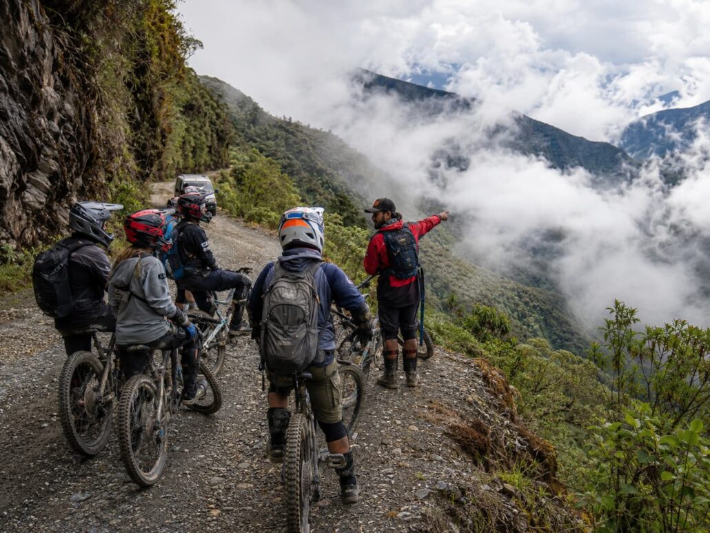
The Death Road is not a technical cycling challenge that requires specialist skills. Most participants have no significant mountain biking experience before they do it. What it does require is appropriately maintained equipment with reliable braking, a guide who knows where the road narrows, where the surface changes, and how to manage a group through the sections where the cliff exposure is highest, and briefing on the specific techniques for steep gravel descent that differ from flatland riding.
Operators like Death Road Bolivia Tours provide high-quality mountain bikes with hydraulic disc brakes, full-face helmets, gloves, and knee and elbow protection, along with guide-led descent with a support vehicle following the group. For technology-focused travelers who want to experience the Death Road as both an adventure and a gear testing environment, the quality of the provided equipment determines how much of the experience is spent managing anxiety about equipment reliability versus paying attention to the road and the view.
7. The Cloud Forest Zone Is a Macro Photography Environment That Challenges Autofocus Systems
The middle section of the Death Road passes through cloud forest where the vegetation comes to within metres of the road edge, the light drops to overcast-diffuse even on clear days above the cloud line, and the moisture in the air creates a slight atmospheric haze that reduces contrast at distance. For photographers carrying camera systems on the descent, this zone presents an autofocus challenge that is different from both bright-daylight sports photography and controlled low-light studio work.
The combination of low contrast, moving subject (other riders), variable distance, and camera movement from the bike itself tests phase-detect autofocus systems in conditions where contrast-detect fallback is slower than the scene requires. Camera systems with subject-tracking AF and eye/face detection that can switch cleanly between subject types (rider in foreground, forest background) handle this better than systems optimised for a single AF use case. The cloud forest is one of those environments where the marketing specification of an AF system and its real-world performance diverge noticeably.
8. The End Point in Coroico Makes the Case for Solar Charging as a Practical Feature
The descent ends in Coroico, a small town in the Yungas valley at around 1,200 metres where the temperature is 20 to 25 degrees warmer than the La Cumbre start point and the subtropical sun is strong enough for meaningful solar charging on any device equipped with the capability. A six-hour descent at altitude, in cold conditions, with continuous GPS recording, camera activity, and heart rate monitoring, produces significant battery drain on every device in the kit. The solar charging capacity that is borderline useful in an urban environment becomes practically relevant when the next reliable power source is an hour away in a warm valley town.
The Death Road descent is, in this sense, a real-world test of whether the features that device manufacturers specify for extreme conditions actually work when the conditions are actually extreme. Battery management at altitude, in cold, with high sensor load, followed by solar recovery in subtropical sun, is a use case that captures the full performance envelope of any wearable or GPS device. The devices that emerge from the descent with useful battery remaining, accurate track logs, and legible footage are the ones that have earned their specifications. The others have provided a different kind of useful data.
A Final Thought
The most informative product test is always the one the manufacturer didn’t design for. Lab certifications tell you what a device can survive under controlled conditions. The Death Road tells you what it actually does when the altitude is real, the dust is real, the moisture is real, and the descent takes four hours instead of thirty minutes in a test rig.
That information is useful whether you are a journalist evaluating gear or a traveler deciding what to carry. The descent also happens to be one of the most spectacular things you can do on a bicycle, which is a secondary benefit that controlled lab tests do not typically offer.
Bring the full-face helmet. Check your brake fluid specification before you go. Make sure the GPS has a fresh calibration. And charge everything the night before, because the starting altitude will cost you more battery than the spec sheet suggests.